
Table of Contents
Introduction
Whenever the construction of a road, highway, building, railway track, canal, industrial project, or township begins, the first and most crucial task is to accurately estimate the earthwork quantity. If the earthwork quantity is miscalculated at the outset, it can negatively impact the project’s budget, planning, manpower requirements, machinery selection, and construction schedule.
Many novice site engineers and civil engineering students mistakenly believe that earthwork simply involves digging and filling soil. However, in a practical site environment, earthwork estimation is a far more detailed process. It involves interpreting survey data, determining the difference between the Existing Ground Level (EGL) and the Formation Level (FL), preparing cross-sections, and subsequently calculating the volume using mathematical methods.

An experienced highway engineer never issues an order for excavation or filling without first verifying the earthwork quantity. The reason is simple: earthwork constitutes a significant portion of a project’s total construction cost. Even a 5% error in estimation can result in a financial discrepancy amounting to lakhs or even crores of rupees in large highway projects.
Nowadays, the use of technologies such as Drone Surveys, Total Stations, DGPS, AutoCAD Civil 3D, and GIS software is making earthwork quantity estimation increasingly accurate. However, understanding basic calculations and manual estimation methods remains essential before utilizing these advanced tools. Without a clear grasp of the fundamental concepts, an engineer would find it difficult to verify the results generated by the software.
In this guide, we will explore earthwork quantity estimation, covering everything from basic principles to practical site-level applications. Each step will be explained in detail, accompanied by numerical examples and formulas, along with references to relevant IS Codes and MoRTH specifications. The objective of this article is not merely to list formulas but to provide a practical approach that you can confidently apply on-site.
What is Earthwork Quantity?
In construction engineering, “Earthwork Quantity” refers to the calculation of the total volume of soil that needs to be excavated (cut) or filled (embankment) for a project. This volume is generally measured in cubic meters (m³).
Earthwork estimation is not limited to excavation alone; it also takes into account various practical factors such as the existing ground survey, proposed design level, side slopes, shrinkage, swell factor, borrow areas, and disposal locations.
Consider a simple example from a highway project. Suppose the Existing Ground Level (EGL) at a specific location is 99.20 m, and the Design Formation Level (FL) is 100.50 m. The difference between the two is 1.30 m, meaning filling work will be required there. Conversely, if the Existing Ground Level at another chainage is 101.80 m and the Formation Level is 100.50 m, then 1.30 m of excavation would be required.
Similarly, the total Earthwork Quantity is determined by comparing the levels at every chainage along the entire alignment.
In practical construction, earthwork is divided into two main categories:
| Earthwork Type | Description | Unit |
|---|---|---|
| Excavation | Removing existing soil | m³ |
| Embankment/Filling | Filling soil to achieve the required level | m³ |
When estimating earthwork quantities, the soil type is just as important as the volume. Excavating clay, sand, gravel, black cotton soil, or rock involves different levels of productivity and cost. For this reason, earthwork is categorized into distinct items within the Bill of Quantities (BOQ).
For a professional Site Engineer, earthwork quantity is not merely a calculation but the foundation of project planning. Decisions regarding the number of dumpers, excavator capacity, labor deployment, and project duration are all based on this estimation.
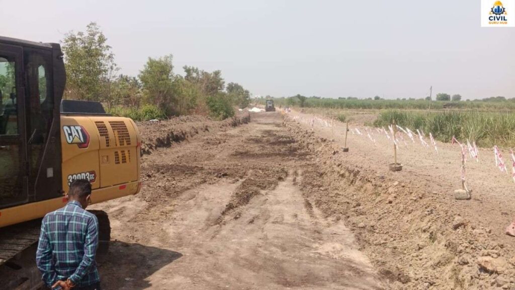
Earthwork excavation
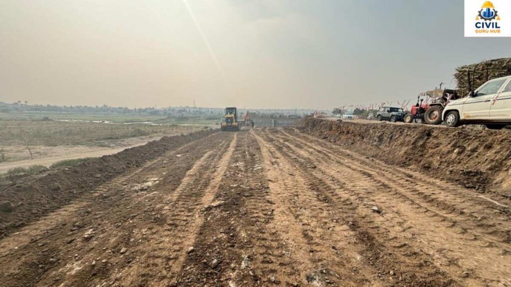
Earthwork Filling
Why is Earthwork Quantity Estimation Important?
If an engineer were asked to identify the most critical calculation in a project, the answer in many cases would be the Earthwork Quantity. This is because, in highway and infrastructure projects, excavation and filling activities directly impact the project from its inception through to completion.
The primary benefit lies in accurate budgeting. When the Earthwork Quantity is calculated correctly, the contractor knows exactly how much excavation, filling, and transportation will be required. This ensures a realistic project cost and helps avoid unnecessary financial losses.
A second benefit relates to machinery planning. If an engineer knows in advance that 50,000 m³ of excavation is required, they can easily determine the number of excavators, dumpers, graders, and compactors to deploy at the site. An incorrect quantity estimate could lead to either idle machinery or project delays.
The third benefit concerns construction scheduling. Earthwork is generally the initial activity of a project. An accurate Earthwork Quantity estimate ensures that planning based on the Critical Path Method (CPM) and bar charts remains realistic.
A fourth benefit involves payment and billing. In both government and private projects, contractors are paid based on the actual measured Earthwork Quantity. If the quantity verification is inaccurate, the likelihood of disputes increases.
Environmental management is also linked to Earthwork estimation. Excessive excavation implies a need for unnecessary disposal areas, while excessive filling requires additional borrow areas; both have environmental impacts. Consequently, Earthwork planning has become a crucial component of sustainable construction in modern highway projects.
An experienced Highway Engineer always compares manual calculations with software-generated Earthwork Quantity figures. This double-verification process helps significantly minimize measurement and survey errors.
Survey Data Required for Earthwork Quantity Estimation
Survey data forms the primary basis for the accuracy of earthwork estimation. If the survey data itself is inaccurate, the final result will not be reliable, regardless of how precise the calculations are.
A topographic survey is the first step conducted at the site. This survey records the Existing Ground Levels (EGL). Levels are taken at the centerline and offset points at every chainage, providing an understanding of the terrain’s actual profile.
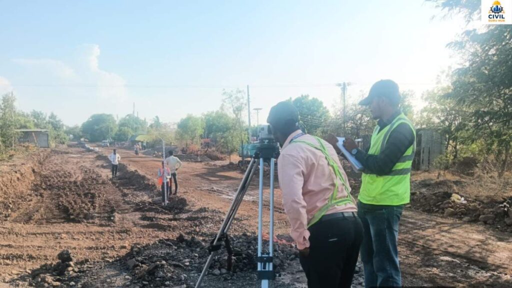
Excavation Level checking
Next, a Longitudinal Section (L-Section) is prepared. This involves comparing the Existing Ground Level with the Proposed Formation Level along the alignment. This comparison helps identify cut and fill zones.
The Cross-Section Survey is another crucial step. Cross-sections are taken at fixed intervals—such as 10m, 20m, or 25m. These intervals may be reduced in areas with curves or uneven terrain. Cross-sections allow for the calculation of the earthwork area at each location, which subsequently serves as the basis for volume calculations.
Chainage marking is vital during the survey. Incorrect chainage recording can lead to a shift in the actual locations for excavation and filling. Therefore, every chainage is meticulously recorded in both the field book and the drawings.
In modern projects, high-accuracy data is collected using Total Stations, DGPS, and drone surveys. However, regardless of how advanced the equipment is, field verification remains essential.
Required Survey Data Table
| Survey Data | Purpose |
|---|---|
| Existing Ground Level (EGL) | Existing surface level |
| Formation Level (FL) | Design level |
| Chainage | Distance reference |
| Cross Section | Area calculation |
| Longitudinal Section | Cut & Fill identification |
| Side Slope | Accurate earthwork volume |
| Soil Type | Cost estimation |
| Borrow Area Details | Filling source planning |
Accurate survey data is the foremost and most critical prerequisite for accurate earthwork quantity estimation.
To read more articles on Quantity Survey, check the following guides:
The Ultimate Concrete Nominal mix: 8 Proven Grades with Calculations
BBS in Construction:A full guide for Calculation, Formula & Examples
How to Calculate Camber Tolerance in Road Construction Step by Step
Step 1: Verify Project Drawings and Survey Data
The first practical step in earthwork estimation is verifying the available drawings and survey records. If there are errors in the survey data, all subsequent earthwork quantity calculations will also be incorrect.
First, gather the approved set of drawings. This generally includes the following documents:
- Alignment Plan
- Longitudinal Section (L-Section)
- Cross Sections
- Formation Level Drawing
- Typical Road Cross Section
- Embankment Details
- Cutting Details
Next, compare the Existing Ground Level (EGL) with the Formation Level (FL).
Example:
| Chainage | EGL (m) | FL (m) | Result |
|---|---|---|---|
| 0+000 | 99.80 | 100.50 | Filling |
| 0+020 | 100.90 | 100.50 | Cutting |
| 0+040 | 99.60 | 100.50 | Filling |
| 0+060 | 101.20 | 100.50 | Cutting |
If the survey data is outdated and site conditions have changed, a fresh survey should be conducted. The ground profile often changes after the rainy season, which can lead to significant differences in earthwork quantities.
In professional practice, an engineer never commences excavation based solely on office drawings without conducting a field verification.

Total station survey
Step 2: Identify Cut and Fill Areas
This is the most important phase of earthwork estimation.
The Existing Ground Level and Formation Level are compared at every chainage.
The formula is very simple:
Difference = Formation Level − Existing Ground Level
If the result is positive:
It means filling is required.
If the result is negative:
It means excavation is required.
Example:
| Chainage | Existing Level | Formation Level | Difference | Work |
|---|---|---|---|---|
| 0+000 | 99.40 | 100.50 | +1.10 | Fill |
| 0+020 | 100.30 | 100.50 | +0.20 | Fill |
| 0+040 | 101.20 | 100.50 | -0.70 | Cut |
| 0+060 | 102.10 | 100.50 | -1.60 | Cut |
This process is repeated along the entire alignment.
Another important concept here is the “Balance Line.”
The point where the Existing Level and Formation Level become equal is called the “Balance Point.”
This point determines where excavation ends and filling begins.
In practical highway projects, a Cut-Fill Diagram is prepared based on this.
If cut and fill quantities are balanced, the requirement for borrow soil is reduced.
For this reason, experienced highway engineers try to minimize earthwork quantities while optimizing the alignment.
Step 3: Calculate the Cross-Sectional Area
Now that the cut and fill values for each chainage are known, the next step is to calculate the cross-sectional area.
The road’s cross-section is generally trapezoidal in shape.
Formula
Area = B × h + (S × h²)
Where
B = Formation Width
h = Height of Fill or Cut
S = Side Slope
Example
Formation Width = 12 m
Height = 2 m
Side Slope = 2
Calculation
Area
= 12 × 2 + (2 × 2²) = 24 + 8
= 32 m²
This means the earthwork area at that chainage is 32 square meters.
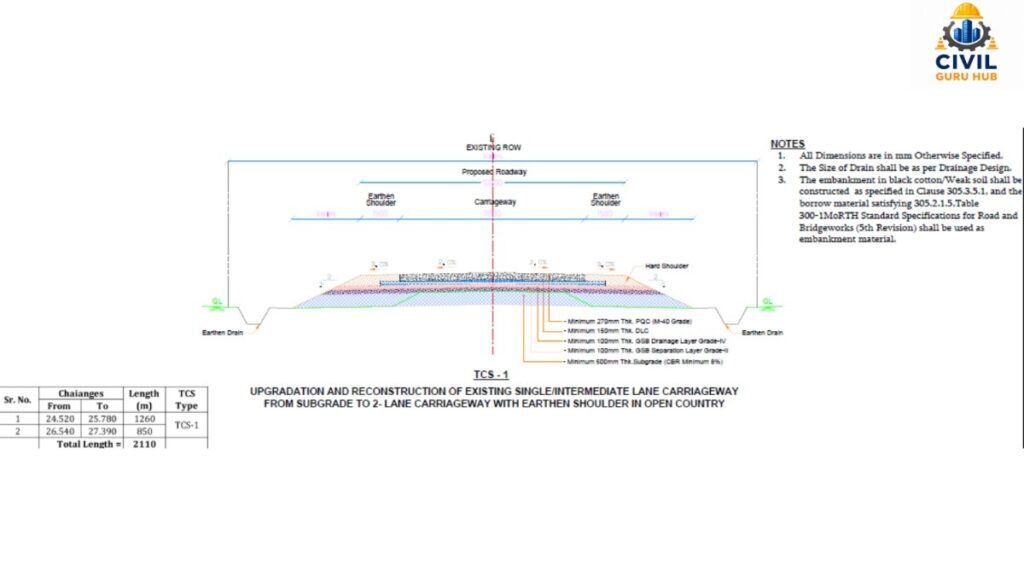
Cross section for earthwork quantity
Example Table
| Formation Width | Height | Slope | Area |
|---|---|---|---|
| 12 | 1.0 | 2 | 14 |
| 12 | 1.5 | 2 | 22.5 |
| 12 | 2.0 | 2 | 32 |
| 12 | 2.5 | 2 | 42.5 |
This area is calculated for every chainage.
If the road width changes or a retaining wall is present, the area will also change.
For this reason, each cross-section should be calculated individually.
Software also operates based on this exact concept.
Step 4: Calculate Earthwork Quantity using the Average End Area Method
The Average End Area Method is the most widely used method in India.
This method is both simple and quite accurate.
Formula
Volume = [(A₁ + A₂) / 2] × L
Where
A₁ = Area of the first cross-section
A₂ = Area of the second cross-section
L = Distance between the sections
Example
Area of Section 1 = 24 m²
Area of Section 2 = 32 m²
Distance = 20 m
Calculation
Average Area = (24 + 32) / 2 = 28 m²
Volume = 28 × 20 = 560 m³
This means the earthwork quantity between the two sections will be
560 cubic meters
Example Table
| Section | Area |
|---|---|
| A1 | 24 m² |
| A2 | 32 m² |
| Distance | 20 m |
| Volume | 560 m³ |
This method yields the best results when there is not much variation between the two cross-sections.
In highway projects, the initial BOQ (Bill of Quantities) estimate is generally prepared using this method.
Step 5: Trapezoidal Method
Engineers often refer to the “Average End Area” method as the Trapezoidal Method because the underlying principle for both is nearly identical.
This method is suitable when the terrain is smooth.
The same formula is used.
Example
Area-1 = 18 m²
Area-2 = 26 m²
Distance = 25 m
Average Area = (18 + 26) / 2 = 22
Volume = 22 × 25 = 550 m³
In this example, the earthwork quantity
will be 550 cubic meters.
The advantage of the Trapezoidal Method is that calculations are very fast.
However, the margin of error can increase on uneven terrain.
For this reason, the Prismoidal Method is often used for roads in mountainous areas.
Step 6: Prismoidal Method
The Prismoidal Formula is considered more accurate when there is significant variation between cross-sections.
Formula
V = (L/6) × (A₁ + 4Aₘ + A₂)
Where
A₁ = First Area
A₂ = Last Area
Aₘ = Middle Area
Example
A₁ = 20 m²
Aₘ = 28 m²
A₂ = 36 m²
Distance = 20 m
Calculation
V = (20/6) × (20 + 112 + 36) = (20/6) × 168
= 560 m³
This method yields highly accurate results for irregular ground profiles.
For this reason, it is widely used in railway, dam, and hill road projects.
Detailed Numerical Example (Step-by-Step)
Now let’s solve a complete example.
Road Width =12 m
Slope=2H:1V
Chainage Interval=20 m
Survey Data
| Chainage | Height |
|---|---|
| 0+000 | 1.2 |
| 0+020 | 1.8 |
| 0+040 | 2.1 |
| 0+060 | 1.6 |
Area Calculation
Chainage 0+000
Area =12×1.2+(2×1.2²) =14.4+2.88
=17.28 m²
Chainage 0+020
Area =21.6+6.48
=28.08 m²
Chainage 0+040
Area =25.2+8.82
=34.02 m²
Chainage 0+060
Area =19.2+5.12
=24.32 m²
Volume Calculation
Between
0+000 and 0+020
=(17.28+28.08)/2×20
=453.6 m³
Between
0+020 and 0+040
=(28.08+34.02)/2×20
=620.9 m³
Between
0+040 and 0+060
=(34.02+24.32)/2×20
=583.4 m³
Total Earthwork Quantity
453.6 + 620.9 + 583.4 = 1657.9 Cubic Meter
This is the same process which is practically done manually in Highway Projects and AutoCAD Civil 3D, MX Road or Open Roads software also calculates Earthwork Quantity on the same principle.
Comparison of Different Methods
| Method | Accuracy | Calculation Speed | Use |
|---|---|---|---|
| Average End Area | High | Fast | Highway |
| Trapezoidal | Medium | Fast | Regular Ground |
| Prismoidal | Very High | Slow | Irregular Terrain |
| Software Calculation | Very High | Very Fast | Large Projects |
To read more articles on Quantity Survey, check the following guides:
How to Create a Flawless Highway Quantity Survey Checklist? 19 Expert-Level Tips
What is Gradient: in Civil Engineering? Complete Explanation
Also you can see the video regarding superelevation and Camber by clicking below links.
Step 7: Understanding Shrinkage and Swell Factors
When soil is excavated from its natural ground state, its volume does not remain constant. Upon excavation, the soil loosens, and its volume may increase; this phenomenon is known as “Swell.” Conversely, when that same soil is compacted for use in an embankment, its volume decreases—a process known as “Shrinkage.”
If an engineer ignores these factors, the estimated quantity of earthwork may differ significantly from actual site requirements.
For example, suppose 1,000 m³ of soil is obtained from excavation. If the soil has a swell factor of 20%, the loose volume will increase to approximately 1,200 m³. However, when this soil is used in an embankment and undergoes proper compaction, the compacted volume will decrease again.
Typical Swell and Shrinkage Values
| Soil Type | Swell (%) | Shrinkage (%) |
|---|---|---|
| Sand | 10–15 | 5–8 |
| Clay | 20–30 | 10–15 |
| Gravel | 8–12 | 3–5 |
| Rock (Blasted) | 40–60 | Not Applicable |
For practical estimation, both the contractor and the consultant should adopt swell and shrinkage values based on the soil investigation report. Relying on assumptions for calculations can lead to future disputes.
Step 8: Lead and Lift Calculation
In earthwork estimation, the volume of excavation is not the only important factor. The distance the soil needs to be transported and the height to which it must be shifted also directly affect the cost.
‘Lead’ refers to the horizontal distance from the excavation point to the disposal or filling location.
‘Lift’ refers to the vertical distance through which the soil needs to be moved.
Example:
Excavation Point = Chainage 0+500
Filling Point = Chainage 1+200
Horizontal Distance = 700 m
If the excavation level is 98.00 m and the filling level is 101.00 m, then the Lift = 3 m.
While the earthwork quantity may remain the same, an increase in Lead and Lift leads to higher costs for dumper fuel, machinery usage, and labor. For this reason, separate payment items for Lead and Lift are often included in the BOQ (Bill of Quantities).
Step 9: Borrow Area and Disposal Planning
In every project, the volume of excavation and filling does not always balance out.
Two situations may arise:
Situation 1: The filling requirement exceeds the excavation volume.
In this case, additional soil must be procured from a borrow area.
Situation 2: The excavation volume exceeds the filling requirement.
In this case, the excess soil must be transported to a disposal yard.
Example:
Total Excavation = 15,000 m³
Total Filling = 18,000 m³
Borrow Soil Requirement = 18,000 − 15,000 = 3,000 m³
Similarly, if excavation is 20,000 m³ and filling is 16,000 m³, then planning for the disposal of 4,000 m³ of soil will be required.
Professional highway engineers prepare a Cut-Fill Balance Chart during project planning to minimize transportation costs.
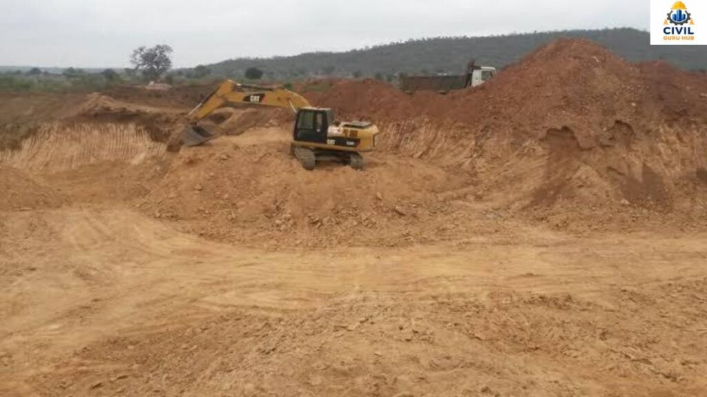
Borrow Area (Soil Quarry)
Measurement of Earthwork Quantities as per IS 1200 (Part 1)
IS 1200 (Part 1) is the widely accepted standard for earthwork measurement in India.
Under this standard, measurements are generally recorded in cubic meters (m³).
Certain important points should be kept in mind during measurement:
- Survey records of the existing ground level must be available.
- The final excavation level must be verified.
- Cross-sections must be approved.
- Payment for over-excavation is generally not permitted unless approved by the engineer.
- Unauthorized excavation is not included in the payable quantity.
For this reason, maintaining site records is crucial.
Common Mistakes in Earthwork Quantity Estimation
In practical projects, many errors arise not from the calculations themselves, but from issues during data collection.
The most common mistakes include:
- Failing to verify the existing ground level.
- Recording incorrect chainage.
- Ignoring side slopes.
- Failing to account for shrinkage and swell factors.
- Using incorrect cross-section spacing.
- Accepting software results without verification.
- Failing to estimate borrow area quantities.
- Ignoring the compaction factor.
An experienced engineer always compares manual calculations with software reports. This practice significantly improves the accuracy of earthwork quantity estimates.
Practical Tips for Highway Engineers
If you are a Site Engineer or a Highway Engineer, these practical suggestions can help make your work more accurate.
- Verify the latest survey data before every earthwork activity.
- Do not forget to conduct a fresh level survey after the rainy season.
- Cultivate the habit of manual calculation; do not rely solely on software.
- Maintain daily records of excavation and filling.
- Periodically compare drone survey data with Total Station data.
- Reduce transportation costs by optimizing the cut-and-fill balance.
- Reconcile earthwork quantities on a weekly basis.
These small practices improve both the quality and profitability of the project.
Get the Quantity calculation excel sheet
Conclusion
Accurate earthwork quantity estimation is a crucial component of the success of any highway, road, railway, or infrastructure project. If the survey data is accurate, the Existing Ground Level (EGL) and Formation Level (FL) are correctly verified, and calculations based on cross-sections are performed using approved methods, then tasks such as excavation, filling, machinery planning, material management, budgeting, and contractor billing can all be completed without major issues. For this reason, every civil engineer should possess practical knowledge of earthwork quantity estimation.
In this comprehensive guide, we have explained earthwork quantity estimation in step-by-step detail. We have covered survey verification, cut-and-fill analysis, cross-section calculations, the Average End Area Method, the Trapezoidal Method, the Prismoidal Method, shrinkage and swell factors, lead-lift calculations, borrow area planning, BOQ preparation, QA/QC verification, and practical site tips, all supported by examples. By following these methods, you can determine accurate earthwork quantities using both manual calculations and modern software.
A skilled highway engineer is one who does not rely solely on software results but is also capable of verifying them through technical calculations. Strong fundamentals, regular practice, and the correct application of standard IS Codes and MoRTH Specifications are the hallmarks of accurate earthwork quantity estimation and successful project execution.
About the Author
My name is Susanta Kumar Mohapatra. I am a Civil Engineering professional with over 11 years of practical experience in the construction and infrastructure sectors. I hold a B.Tech degree in Civil Engineering and an M.E. degree in Construction Management. Throughout my professional career, I have worked in key areas such as road construction, bridge projects, quality control, material testing, concrete mix design, highway engineering, quantity estimation, project planning, site execution, and construction management.
I launched CivilGuruHub.com with the aim of sharing my passion for Civil Engineering and my practical knowledge with a wider audience. The primary objective of this website is to provide practical, industry-oriented information in simple language to Civil Engineering students, site engineers, quality engineers, quantity surveyors, contractors, and construction professionals. Here, I publish detailed, original, and research-based articles on topics such as construction technology, concrete technology, highway engineering, structural engineering, material testing, IS codes, IRC codes, quantity surveying, estimation and costing, project management, tendering, and Civil Engineering calculators.
Alongside the website, I also run a YouTube channel named “The Civil Site,” where I explain practical site experiences, laboratory tests, construction techniques, engineering calculations, software tutorials, and technical concepts through easy-to-understand videos. My goal is to ensure that every student and engineer understands not just the theory, but also its practical application.
Additionally, I share educational content related to general knowledge, quizzes, and competitive exam preparation through my YouTube channel, “Daily IQ Hub.” The aim of this channel is to enhance viewers’ knowledge and strengthen their exam preparation.
I believe that a successful engineer is one who is always ready to learn and continuously updates their practical knowledge. With this mindset, I always strive to provide high-quality, reliable, practical, and industry-standard content through CivilGuruHub.com and my YouTube channels, enabling every reader and viewer to excel in their careers.
Thank you sincerely for your trust and support. I am confident that CivilGuruHub.com and my educational platforms will prove to be reliable companions in your learning journey and professional growth. If you wish to take your knowledge in the field of Civil Engineering to the next level, please continue to follow our articles and videos regularly. We will keep bringing you fresh, practical, and industry-focused content.
Frequently Asked Questions (FAQs)
Q 1. In what unit is earthwork quantity measured?
Answer: Earthwork quantity is generally measured in cubic meters (m³).
Q 2. What is the most common calculation method used in highway projects?
Answer: The Average End Area Method is the most widely used because it is simple and practical.
Q 3. Can earthwork quantity be estimated without using software?
Answer: Yes. Manual calculations can easily be performed using the Cross-Section and Average End Area methods.
Q 4. Which survey is the most important for earthwork quantity estimation?
Answer: Both Longitudinal Section and Cross-Section surveys are crucial.
Q 5. Can shrinkage and swell factors be ignored?
Answer: No. Ignoring these factors can lead to a significant discrepancy between the calculated earthwork quantity and the actual requirements at the site.
Q 6. Which software is best for earthwork quantity estimation?
Answer: Currently, AutoCAD Civil 3D, Open Roads Designer (Bentley), MX Road, and Trimble Business Center are the most widely used software for earthwork quantity estimation. These software applications calculate cut and fill quantities automatically by comparing the existing ground surface with the design surface. However, it is considered professional practice to verify the software’s results with manual calculations before finalizing them; this helps identify calculation errors and survey mistakes.
Q 7. What is the difference between the Average End Area Method and the Prismoidal Method in earthwork quantity estimation?
Answer: The Average End Area Method is used for simple and rapid calculations. It is the most common method for highway projects and yields fairly accurate results for regular terrain. On the other hand, the Prismoidal Method takes the middle cross-section into account, making it more accurate for irregular or hilly terrain. The Prismoidal Method is the better choice when there is significant variation in the ground profile between cross-sections.
Q 8. What is the most common mistake made when estimating earthwork quantities?
Answer: The biggest mistake is starting calculations without verifying the Existing Ground Level (EGL). Other common errors include mistakes in recording chainage, ignoring side slopes, failing to account for shrinkage and swell factors, and accepting software output without checking it. These minor errors can lead to significant discrepancies in the final earthwork quantity, directly impacting project costs and billing.
Q 9. How does earthwork quantity estimation affect project costs?
Answer: Earthwork quantity estimation is directly linked to the project budget. Factors such as excavation, filling, dumper transportation, machinery requirements, diesel consumption, labor costs, and construction duration are determined based on this estimate. Even a 5–10% error in the earthwork quantity estimate can result in a financial impact of lakhs or crores of rupees in large highway projects. That is why accurate estimation is considered the most important planning stage of any civil engineering project.
Q 10. Which IS Codes and MoRTH Specifications should be followed when estimating earthwork quantities?
Answer: In India, IS 1200 (Part 1) is the most important standard for measuring earthwork quantities, as it outlines the standard procedure for such measurements. IS 1498 is referred to for soil classification, while MoRTH Section 300 is followed for earthwork execution and embankment construction in highway projects. Adhering to these standards ensures uniformity and accuracy across estimation, execution, and billing.